
CPL » Meteorology » Regional Meteorological Services, Reports and Forecasts
Regional Meteorological Services, Reports and Forecasts
20.2.2 Explain in plain language the coded or pictorial information contained in:
(a) GRAFOR; Graphical Aviation Forecast
A GRAFOR is a low-level graphical aviation forecast showing forecast flight conditions from the surface to FL100.
It is mainly intended for planning and conducting VFR flights in New Zealand.
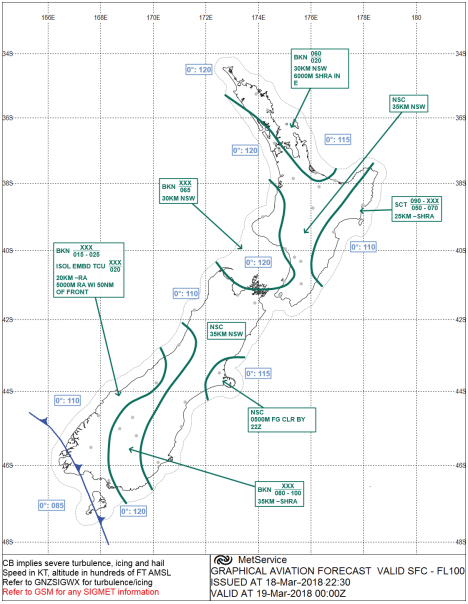
GRAFOR Decoded
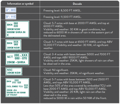
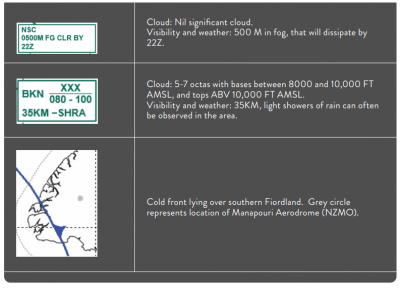
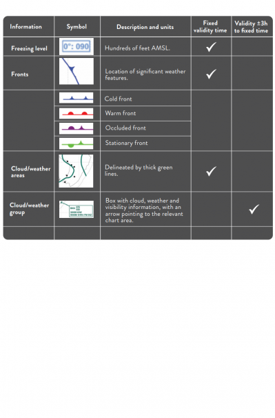
Chart Elements
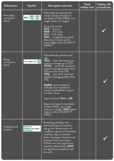
Issue and validity
GRAFORs are issued twice daily for the New Zealand FIR.
Each issue contains three charts, giving a total forecast coverage of 18 hours.
Each chart has a fixed validity time.
Some chart elements apply at the fixed validity time, while cloud, weather and visibility information generally applies for 3 hours before and 3 hours after the stated validity time.
Note: The plain-language times in brackets refer to New Zealand local time.
Issue 1
Issue 1 is made available at:
1100 UTC — (late night)
To see more, you must subscribe for licence "CPL" or sesssion "Meteorology"