PPL » Navigation » Chart Reading
6.26 Chart Reading
6.26.2 Interpret the features and symbols of a NZ Aeronautical Chart.
A New Zealand aeronautical chart is designed to provide pilots with clear visual information needed for safe navigation.
By correctly interpreting the chart’s features and symbols, a pilot can identify aerodromes, airspace boundaries, terrain, obstacles, navigation aids, and other operational information relevant to flight.
Charts are drawn to scale and use standardised symbols and colours so that pilots can quickly recognise important information.
The Legend
The legend on an aeronautical chart is the section that explains the meaning of all the symbols, colours, and markings used on the chart.
Think of it as the chart’s key or decoding guide—it tells you how to interpret everything you see.
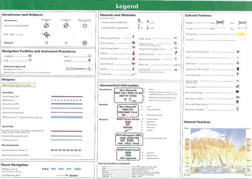
A Closer Look at the Legend
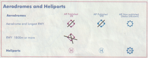
Aerodrome Symbols
Aerodromes are represented by specific symbols that provide information about the type and status of the aerodrome.
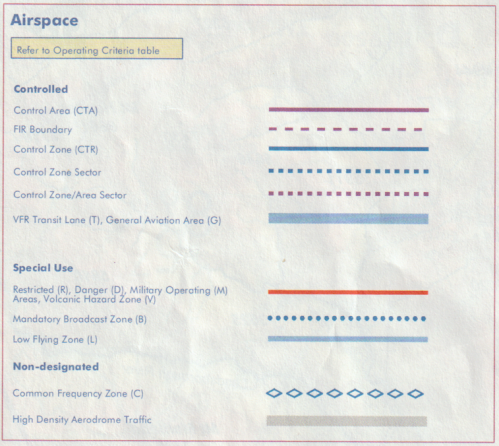
Airspace Boundaries
Aeronautical charts display the boundaries of various types of airspace to help pilots comply with airspace rules.
Aeronautical Hazards and Obstacles
Aeronautical charts also identify hazards and obstacles that could present a risk to aircraft operations.